A county border anomaly
The village of Coleshill, part of the parish of Amersham, Buckinghamshire was also once in Hertfordshire

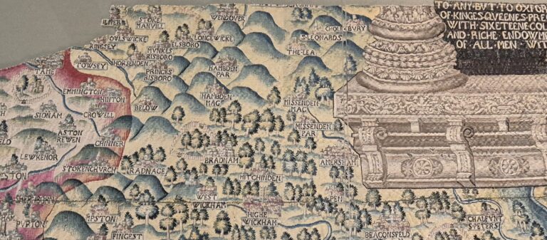
I spend a lot of time looking at maps, particularly of Amersham, and recently looked at the delightful 1611-12 John Speed map of Buckinghamshire which is available on the University of Cambridge Digital Library website, along with a host of other fascinating images.
I was surprised to see that the village of Coleshill (Colshull on the map) near Amersham (Agmundesham on the map) sits on its own in a tiny island of Hertfordshire, adrift in a sea of Buckinghamshire.
A quick search for local websites that might reveal the history turned up the Coleshill page on the Hertfordshire genealogy site which gives confirmation, at least, that the map is correct and that it was once simultaneously part of the parish of Amersham in Buckinghamshire, and also in the Hundred of Dacorum, Hertfordshire. The page only goes on to say that this is for ‘ancient historical reasons’, so that has not cleared up the mystery.
I did, however, uncover an article in the archive of Beaconsfield Historical Society entitled ‘”Little Hertfordshire” a Discrete located in Buckinghamshire’, which I’m sure holds the answers, if I can only make it along there to find out.
Do let me know if you have any idea why this village lived in its own little pocket of Hertfordshire in the 17th century, otherwise it’s likely to sit in my ever expanding list of interesting things to look at for some time