Marvellous mapestry
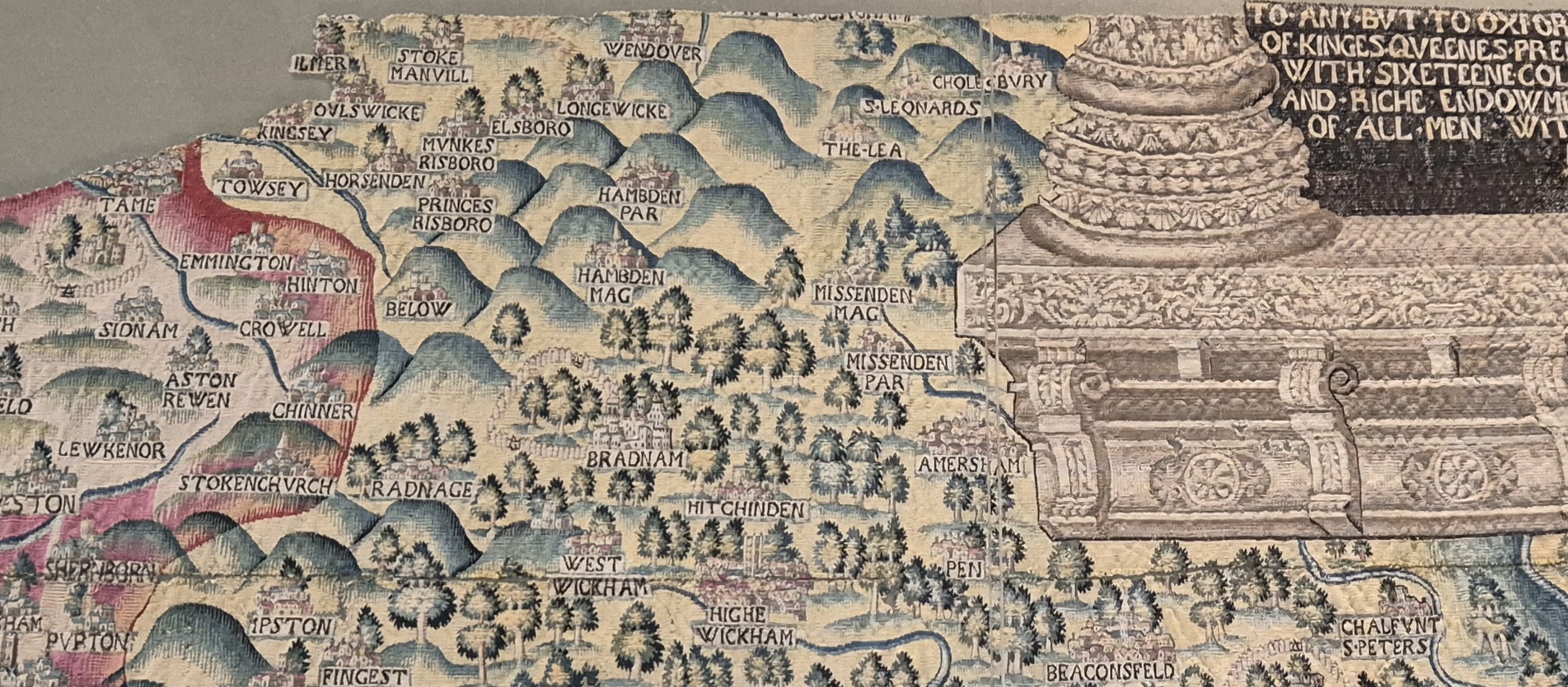
I went to the Weston Library in Oxford for a meeting. About maps, obviously. In the Blackwell Hall there is an enormous tapestry map, one of four, each of which covers one of four counties: Oxfordshire, Worcestershire, Gloucestershire and Warwickshire. The part they have on display is, as you would expect, the one which covers Oxfordshire.
They were commissioned by Ralph Sheldon, a very rich landowner. He had his house portrayed as disproportionately large on each of the tapestry maps, and why not, if you’re commissioning it.
There are large sections of the map that are missing, some through damage, and other parts because they were deliberately cut out and given to people. What remains though, is fabulous to look at, both in colour and detail, it’s an incredible survivor which is well worth a visit.
Given the partial nature of the tapestry, and the fact that it is focussed on Oxfordshire, I hadn’t expected Amersham to appear on it, but just by the scroll up towards the top left of the map, there it is.
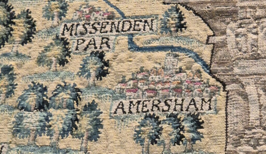
It looks surprisingly accurate for a depiction on a tapestry that is over 430 years old. You can see the relative size in comparison to nearby Missenden and Penn. The Misbourne snakes through the landscape nearby. You can also make out the church tower which is exaggerated in size as all the others are on the map, possibly as a depiction of their relative importance compared to the other buildings in the town.
It wasn’t the purpose of my visit there, but it was a highlight. There’s so much to see on the map, including Oxford and London. It’ll certainly be something I stop and look at every time I visit there from now on.